It is early the next morning, too early perhaps, that you have gathered at the central garrison. Sheriff Hemlock walks with you towards the north gate.
"It is a six mile walk, or so. You take the road all the way, past the Old Lighthouse, and then along the coast. Eventually you will start to veer away from the coast, skirting along the edge of Shank's Wood. Beyond that are the small mounds we call 'Pauper's Graves', and then the Nettlewood. The Thistletop goblins like within the Nettlewood, or at least they live on an island just off the coast, but you have to go through the Nettlewood to get to the bridge that takes you to the island."
He pauses as you near the gate, not yet finished with his directions.
"What to do is, take the Lost Coast Road east until you hit the Thistle River. This is a mile or two after you start walking with the Nettlewood on your left. The river spills out into the sea just a shade east of the Thistletop island, so one route is to follow the river into the Nettlewood until you find a goblin trail. At worst, you will hit the north coast and should be able to see the island off the coast and correct your path."
He hands you a crude map.
"Beware, though. They may be goblins, but they are numerous, and their leader is strong, and you will be fighting on their terms! Come back to us in one piece. I am not sure what we will do if you fail. Good luck!"
He nods, turns, and trudges off through the muddied streets, turned slick by the rain that has been falling all morning.
It is time to leave.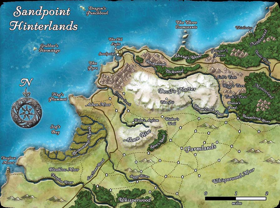
DM: Leaving Sandpoint
Posted by Miguel Enrico Gonzales at 11:30 PM
Labels: campaign stuff
Subscribe to:
Post Comments (Atom)
Etiquetas
- arao (3)
- campaign stuff (405)
- converting your character (12)
- core rulebooks (3)
- daily art preview (35)
- design and development (31)
- Dragon Magazine (1)
- excerpts (25)
- griffyn (2)
- Gryffin (1)
- guilliaume (22)
- Kythan (1)
- lloyd (3)
- nualia (4)
- On the Set of 4th Edition (3)
- OOC (13)
- player character (7)
- rhonna (10)
- sandpoint (5)
2 comments:
request link to the crude map jpeg plz.
also link to the map of the sandpoint hinterlands.
the church (and the library) should have detailed maps of the region yes?
Post a Comment